Súbor:Caspianseamap.png
Vzhľad

Veľkosť tohto náhľadu: 598 × 600 pixelov. Iné rozlíšenia: 239 × 240 pixelov | 600 × 602 pixelov .
Pôvodný súbor (600 × 602 pixelov, veľkosť súboru: 200 KB, MIME typ: image/png)
História súboru
Po kliknutí na dátum/čas uvidíte ako súbor vyzeral vtedy.
| Dátum/Čas | Náhľad | Rozmery | Používateľ | Komentár | |
|---|---|---|---|---|---|
| aktuálna | 15:59, 31. júl 2024 |  | 600 × 602 (200 KB) | Iktsokh | Clearing the map |
| 02:00, 20. august 2018 |  | 600 × 602 (196 KB) | SteinsplitterBot | Bot: Image rotated by 180° | |
| 10:01, 19. august 2018 |  | 600 × 602 (196 KB) | SteinsplitterBot | Bot: Image rotated by 180° | |
| 20:40, 8. január 2007 |  | 600 × 602 (199 KB) | Kmusser | ||
| 20:23, 8. január 2007 |  | 600 × 602 (212 KB) | Kmusser | ||
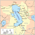
| 20:14, 8. január 2007 |  | 600 × 602 (212 KB) | Kmusser | This is a map of the Caspian Sea including a small locator map. The drainage basin of the Caspian Sea is in yellow. The map is based on USGS and Digital Chart of the World data. Note t |
Použitie súboru
Na tento súbor odkazuje nasledujúca stránka:
Globálne využitie súborov
Nasledovné ďalšie wiki používajú tento súbor:
- Použitie na af.wikipedia.org
- Použitie na am.wikipedia.org
- Použitie na an.wikipedia.org
- Použitie na ar.wikipedia.org
- Použitie na az.wikipedia.org
- Použitie na az.wiktionary.org
- Použitie na ba.wikipedia.org
- Použitie na be.wikipedia.org
- Použitie na br.wikipedia.org
- Použitie na ca.wikipedia.org
- Použitie na csb.wikipedia.org
- Použitie na cs.wikipedia.org
- Použitie na cv.wikipedia.org
- Použitie na de.wikipedia.org
- Použitie na en.wikipedia.org
- Použitie na en.wikivoyage.org
- Použitie na eo.wikipedia.org
- Použitie na es.wikipedia.org
- Použitie na eu.wikipedia.org
- Použitie na fa.wikipedia.org
- Použitie na fa.wikibooks.org
- Použitie na fi.wikipedia.org
- Použitie na fo.wikipedia.org
- Použitie na fr.wikipedia.org
- Použitie na gan.wikipedia.org
- Použitie na gd.wikipedia.org
- Použitie na gu.wikipedia.org
Zobraziť ďalšie globálne použitie tohto súboru.


