
Súbor:CongoLualaba watershed topo.png
Veľkosť tohto náhľadu: 721 × 599 pixelov. Iné rozlíšenia: 289 × 240 pixelov | 578 × 480 pixelov | 924 × 768 pixelov | 1 150 × 956 pixelov .
Pôvodný súbor (1 150 × 956 pixelov, veľkosť súboru: 768 KB, MIME typ: image/png)
Zhrnutie
| Popis |
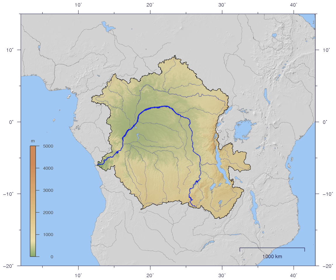
English: Course and Watershed of the Congo and Lualaba River with topography shading.
Deutsch: Verlauf und Einzugsgebiet von Kongo und Lualaba mit Reliefschattierung. |
| Dátum | |
| Zdroj | The map has been created with the Generic Mapping Tools: http://gmt.soest.hawaii.edu/ using additional public comain data from the VMAP0 data set. |
| Autor | Imagico |
| Povolenie (Využívanie tohto súboru) |
Tento súbor podlieha licencii Creative Commons Attribution-Share Alike 2.5 Generic
|
| Ďalšie verzie |
Derivative works of this file: Aruwimi-Ituri.png Image:CongoLualaba_watershed_plain.png |
Licencovanie
Ja, držiteľ autorských práv k tomuto dielu ho týmto zverejňujem za podmienok nasledovnej licencie:
Tento súbor podlieha licencii Creative Commons Attribution-Share Alike 2.5 Generic
- Môžete slobodne:
- zdieľať – kopírovať, šíriť a prenášať dielo
- meniť ho – upravovať dielo
- Za nasledovných podmienok:
- uvedenie autorov – Musíte spomenúť autorov (jednotlivo alebo kolektívne), poskytnúť odkaz na licenciu a uviesť, či ste niečo zmenili. Môžete to urobiť ľubovoľným primeraným spôsobom, ale nie spôsobom naznačujúcim, že poskytovateľ licencie podporuje vás alebo vaše použitie diela.
- meniť za rovnakých podmienok – Ak toto dielo zmeníte, prevediete do inej formy alebo použijete ako základ iného diela, musíte výsledok šíriť pod rovnakou alebo kompatibilnou licenciou ako originál.
História súboru
Po kliknutí na dátum/čas uvidíte ako súbor vyzeral vtedy.
| Dátum/Čas | Náhľad | Rozmery | Používateľ | Komentár | |
|---|---|---|---|---|---|
| aktuálna | 19:59, 2. január 2007 | | 1 150 × 956 (768 KB) | Imagico | {{Information |Description= {{en|Course and Watershed of the Congo and Lualaba River with topography shading.}} {{de|Verlauf und Einzugsgebiet von Kongo und Lualaba mit Reliefschattierung.}} |Source=The map has been created with the [[:en:Generic Mapping |
Použitie súboru
Na tento súbor odkazuje nasledujúca stránka:
Globálne využitie súborov
Nasledovné ďalšie wiki používajú tento súbor:
- Použitie na af.wikipedia.org
- Použitie na als.wikipedia.org
- Použitie na ar.wikipedia.org
- Použitie na arz.wikipedia.org
- Použitie na as.wikipedia.org
- Použitie na az.wikipedia.org
- Použitie na ba.wikipedia.org
- Použitie na be.wikipedia.org
- Použitie na bg.wikipedia.org
- Použitie na bn.wikipedia.org
- Použitie na bo.wikipedia.org
- Použitie na br.wikipedia.org
- Použitie na ca.wikipedia.org
- Použitie na ceb.wikipedia.org
- Použitie na ckb.wikipedia.org
- Použitie na cs.wikipedia.org
- Použitie na da.wikipedia.org
- Použitie na de.wikipedia.org
- Použitie na dsb.wikipedia.org
- Použitie na en.wikipedia.org
- Použitie na en.wiktionary.org
- Použitie na eo.wikipedia.org
- Použitie na es.wikipedia.org
- Použitie na et.wikipedia.org
- Použitie na fi.wikipedia.org
- Použitie na fo.wikipedia.org
- Použitie na frr.wikipedia.org
- Použitie na fr.wikipedia.org
Zobraziť ďalšie globálne použitie tohto súboru.