Preskočiť na obsah

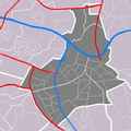
Súbor:Map - NL - Nijmegen.PNG

Obsah stránky nie je podporovaný v iných jazykoch.
z Wikipédie, slobodnej encyklopédie

Map_-_NL_-_Nijmegen.PNG (591 × 590 pixelov, veľkosť súboru: 31 KB, MIME typ: image/png)

Tento zdieľaný súbor je z Wikimedia Commons a je možné ho používať na iných projektoch. Nižšie sú zobrazené informácie z popisnej stránky súboru.

Popis Locator maps of Nijmegen
Zdroj Vlastné dielo
Autor M.Minderhoud
Povolenie
(Využívanie tohto súboru)
© Držiteľ autorských práv tohto súboru, Centraal Bureau voor de Statistiek, umožňuje komukoľvek používať ho na akýkoľvek účel, za predpokladu, že bude správne označený držiteľ autorských práv. Redistribúcia, tvorba odvodených diel, komerčné využitie a všetky ďalšie použitia sú povolené.

This image is (in part or entirely) based on geographical data from Statistics Netherlands (Centraal Bureau voor de Statistiek). Digital geometry files in ESRI format can be downloaded from their website [1].

In particular, boundary data of statistical districts is based on either the Wijk- en buurtkaart 2005, or the Wijk- en buurtkaart 2003 ("CBS/TOPgrenzen"). Data on localities (bevolkingskernen) are from the publication Bevolkingskernen in Nederland 2001.

Conditions of use (in Dutch):

  • Bij visualisering van gegevens met behulp van het digitale bestand Wijk- en buurtkaart 2005 dient te worden vermeld:
Bron: © 2006, Centraal Bureau voor de Statistiek / Topografische Dienst Kadaster
  • Bij visualisering van gegevens met behulp van het digitale bestand CBS/TOPgrenzen dient te worden vermeld:
Grenzen ondergrond: © 2003, Centraal Bureau voor de Statistiek/Topografische Dienst Kadaster
  • Bij visualisering van gegevens met behulp van het digitale bestand "Bevolkingskernen 2001" dient te worden vermeld:
Bron: © 2005, Centraal Bureau voor de Statistiek

Unless otherwise specified, data on waterways and lakes are from the public domain Digital Chart of the World.

Štítky

Pridajte jednoriadkové vysvetlenie, čo tento súbor predstavuje

Položky prezentované týmto súborom

motív

História súboru

Po kliknutí na dátum/čas uvidíte ako súbor vyzeral vtedy.

Dátum/ČasNáhľadRozmeryPoužívateľKomentár
aktuálna22:02, 2. október 2006Náhľad verzie z 22:02, 2. október 2006591 × 590 (31 KB)Michiel1972{{Information |Description= Locator maps of Nijmegen |Source= own work |Date= |Author= M.Minderhoud |Permission= {{Statistics Netherlands map}} |other_versions= }} category:Maps of Nijmegen

Na tento súbor odkazuje nasledujúca stránka:

Globálne využitie súborov

Nasledovné ďalšie wiki používajú tento súbor:

  • Použitie na de.wikipedia.org