
Súbor:Map of Kiribati CIA WFB.png
Nie je dostupné vyššie rozlíšenie.
Map_of_Kiribati_CIA_WFB.png (325 × 350 pixelov, veľkosť súboru: 9 KB, MIME typ: image/png)

|
Tento obrázek (skupina map) by měl být vytvořen pomocí vektorové grafiky jako SVG soubor. To má několik výhod; podrobnosti najdete na stránce Commons:Media for cleanup. Je-li SVG verze tohoto obrázku již k dispozici, prosím nahrajte ji. Po nahrání nahraďte tuto šablonu šablonou {{Vector version available|jméno nového obrázku.svg}}.
|
Zhrnutie
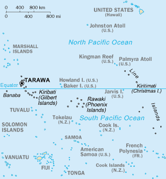
CIA-WF map of Kiribati
Licencovanie
Tento obrázek je volné dílo, jelikož obsahuje materiál původně pocházející z publikace The World Factbook vytvářené Ústřední zpravodajskou službou Spojených států amerických.
|
 |
História súboru
Po kliknutí na dátum/čas uvidíte ako súbor vyzeral vtedy.
| Dátum/Čas | Náhľad | Rozmery | Používateľ | Komentár | |
|---|---|---|---|---|---|
| aktuálna | 15:35, 17. september 2010 | | 325 × 350 (9 KB) | Ras67 | cropped |
| 09:15, 27. marec 2005 |  | 330 × 354 (10 KB) | Wolfman~commonswiki | {{CIA-map}} |
Použitie súboru
Na tento súbor odkazuje nasledujúca stránka:
Globálne využitie súborov
Nasledovné ďalšie wiki používajú tento súbor:
- Použitie na af.wikipedia.org
- Použitie na avk.wikipedia.org
- Použitie na azb.wikipedia.org
- Použitie na ban.wikipedia.org
- Použitie na bjn.wikipedia.org
- Použitie na br.wikipedia.org
- Použitie na bs.wikipedia.org
- Použitie na ceb.wikipedia.org
- Použitie na cs.wikipedia.org
- Použitie na da.wikipedia.org
- Použitie na de.wikivoyage.org
- Použitie na en.wikipedia.org
- Howland Island
- Jarvis Island
- Line Islands
- Tabuaeran
- List of towns and villages in Kiribati
- Lists of hospitals in Oceania
- Talk:List of sovereign states and dependent territories in Oceania
- List of airports in Kiribati
- Wikipedia:Featured picture candidates/February-2007
- Wikipedia:Featured picture candidates/Kingman Reef
- Outline of Kiribati
- Wikipedia:Graphics Lab/Image workshop/Archive/Nov 2008
- Ministry of Line and Phoenix Islands Development
- Použitie na en.wikisource.org
- Použitie na en.wikiversity.org
- Použitie na eo.wikipedia.org
- Použitie na es.wikipedia.org
- Použitie na et.wikipedia.org
- Použitie na eu.wikipedia.org
- Použitie na fa.wikipedia.org
- Použitie na fi.wikipedia.org
Zobraziť ďalšie globálne použitie tohto súboru.