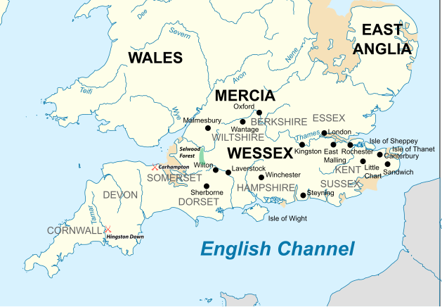
Súbor:Southern British Isles 9th century.svg
Vzhľad

Veľkosť tohoto PNG náhľadu tohoto SVG súboru: 629 × 435 pixelov. Iné rozlíšenia: 320 × 221 pixelov | 640 × 443 pixelov | 1 024 × 708 pixelov | 1 280 × 885 pixelov | 2 560 × 1 770 pixelov .
Pôvodný súbor (SVG súbor, 629 × 435 pixelov, veľkosť súboru: 1,95 MB)
História súboru
Po kliknutí na dátum/čas uvidíte ako súbor vyzeral vtedy.
| Dátum/Čas | Náhľad | Rozmery | Používateľ | Komentár | |
|---|---|---|---|---|---|
| aktuálna | 17:30, 19. júl 2015 |  | 629 × 435 (1,95 MB) | Philg88 | User requested modifications |
| 16:00, 19. júl 2015 |  | 629 × 435 (1,65 MB) | Philg88 | {{Information |Description ={{en|1=Map of the Southern British Isles during the 9th century}} |Source ={{own}} Incorporates elements of [https://commons.wikimedia.org/wiki/File:British_Isles_10th_century.svg this map] |Author =[[User... |
Použitie súboru
Na tento súbor odkazuje nasledujúca stránka:
Globálne využitie súborov
Nasledovné ďalšie wiki používajú tento súbor:
- Použitie na bn.wikipedia.org
- Použitie na br.wikipedia.org
- Použitie na cs.wikipedia.org
- Použitie na el.wikipedia.org
- Použitie na en.wikipedia.org
- Použitie na es.wikipedia.org
- Použitie na fa.wikipedia.org
- Použitie na fi.wikipedia.org
- Použitie na he.wikipedia.org
- Použitie na ja.wikipedia.org
- Použitie na ko.wikipedia.org
- Použitie na ms.wikipedia.org
- Použitie na th.wikipedia.org
- Použitie na tr.wikipedia.org
- Použitie na zh.wikipedia.org
